Arsip:

SDGs

Three Students from TSPD SV UGM Win First Place in PT Kompas Navigasi Indonesia’s Scientific Writing Competition with the Design of the AGRIDOC Application

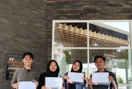
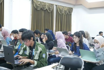
Yogyakarta, 14 May 2024 – Three students from the General Surveying and Mapping Technology Program at UGM Vocational School have once again achieved remarkable success in a national-level competition. In the Scientific Writing Contest organized by PT Kompas Navigasi Indonesia, the TSPD UGM student team secured first place, outshining dozens of participants from various universities across Indonesia. The team, calling themselves “Sunda Pride,” consists of Ridho Haikal Permana, M. Zulfan Dwi Sukasyah, and Farizi Hibatul Hakim.

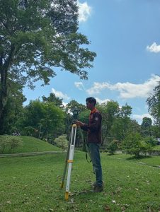
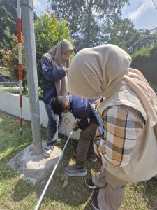
The PT Kompas Navigasi Indonesia Scientific Writing Contest is a competition aimed at fostering innovation in technology, with a focus on practical and applicable solutions. Under the theme “Exploring GNSS Technology Applications in Achieving Sustainable Development in Indonesia,” the Sunda Pride team submitted a scientific paper on AGRIDOC, an innovative application that utilizes GNSS systems on drones for monitoring crop health in smart agriculture.

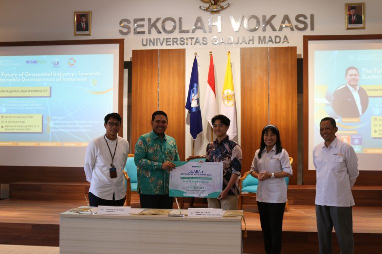
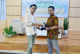
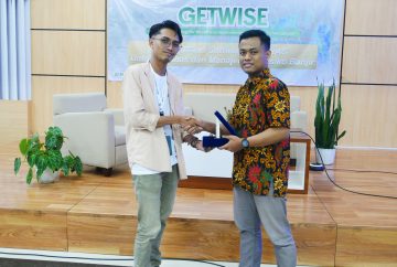
In the photo, Ridho, as the representative of the Sunda Pride team, proudly receives the award from the CEO of PT Kompas Navigasi Indonesia. The award ceremony was also attended by the Head of the Department of Earth Technology (DTK) and the Vice Dean of UGM Vocational School, who offered their support and congratulations to the team. They expressed their joy upon being announced as the winners. During the competition, the Sunda Pride team effectively presented the potential and design of the AGRIDOC application, impressing the judges with their smart solution.

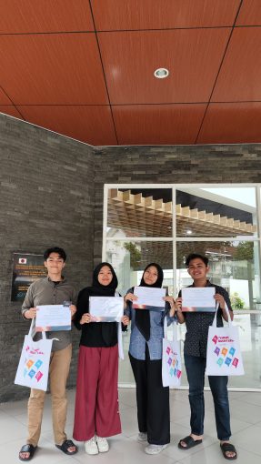
The competition consisted of several stages, including online registration, abstract submission, paper submission, project presentation, and judging by the panel. On 7 May 2024, the finalists presented their work, and the Sunda Pride team was chosen as the overall winner. The team received a certificate, merchandise, a cash prize of Rp1,300,000.00, and a SingularXYZ Y1 GNSS Receiver Geodetic GPS grant.

Ridho Haikal Permana, the leader of the Sunda Pride team, stated, “We are very grateful for the opportunity provided by PT Kompas Navigasi Indonesia. This victory is the result of our hard work and dedication. We hope that the AGRIDOC application design can have a positive impact on the agricultural sector and help achieve sustainable development in Indonesia.”

With a spirit of innovation and support from PT Kompas Navigasi Indonesia, this competition has successfully provided a platform for students to showcase their creativity in GNSS technology. It is hoped that the solution developed by the Sunda Pride team will continue to evolve and be applied more widely, advancing the agricultural sector and supporting sustainable development goals in Indonesia.


The TSPD Student Team from UGM Vocational School Wins Second Place in Mapping and Receives the “Most Unique Video Presentation” Award at the 2023 SuperMap GIS Contest

On September 15, 2023, the GIS Contest SuperMap 2023, an international competition that brings together students from around the world to showcase innovations in mapping and spatial analysis using SuperMap software, was held online. In this competition, the team from the Basic Surveying and Mapping Technology Program at UGM Vocational School successfully secured second place in the Mapping category with the “Most Unique Video Presentation” award. This achievement was earned through their project, which focused on waste accumulation and methane emissions at landfill sites.

The photo above shows the moment when the certificate and merchandise were presented to the second-place winners in the Mapping category, the UGM team, consisting of Ridho Haikal Permana, Farizi Hibatul Hakim, Ummi Kun Barorotur Rofiah, and Nadifa Ramadhani. They succeeded in winning the award at the national event organized by SuperMap, one of the largest GIS companies in Asia.

The GIS Contest SuperMap 2023 began with the participant registration process, followed by the submission of projects, reports, and raw data by each team. The categories competed in included Mapping and Application Analysis. The UGM team chose to compete in the Mapping category, focusing on a highly relevant environmental issue: predicting waste accumulation and methane emissions at landfill sites.

The project work began with the collection and analysis of spatial data related to landfill sites in various regions of Indonesia. Using SuperMap iDesktopX version 10i software, the team processed the data to produce a unique and informative thematic map. This map visualized the potential waste accumulation and methane emissions projected through 2045, in line with the Vision Indonesia Emas 2045.

After completing the project, the UGM team compiled a detailed report and a video presentation highlighting their work. This video featured explanations of the background on potential waste accumulation and methane emissions, with unique animations and data visualizations, which captured the judges’ attention and led the UGM team to win the “Most Unique Video Presentation” award.

During an interview, members of the UGM team stated that their choice of topic was driven by their concern about Indonesia’s increasingly urgent waste management issues. “We want to make a real contribution to better waste management in the future,” said one of the team members.

The UGM team’s success in winning second place in the Mapping category with the “Most Unique Video Presentation” award at the GIS Contest SuperMap 2023 underscores their ability to integrate GIS technology with the analysis of real-world environmental problems. This project provides significant contributions by offering data and insights that can be utilized by the government and other stakeholders in efforts toward more efficient and sustainable waste management. The UGM team hopes that their work will inspire and guide similar projects in the future, supporting the creation of a better environment toward Vision Indonesia Emas 2045.


Field Practicum – Survey Mapping: Detailed Measurements at the Wisdom Area by TSPD Students 2023

In May 2024, TSPD students from the 2023 cohort conducted their Survey Mapping 2 course practicum directly in the field. The entire cohort was divided into twelve groups, each assigned a different measurement area within UGM’s Wisdom Park to carry out detailed measurements. This activity aimed to train and assess students’ competencies in the Survey Mapping 2 Practicum course.

The measurements began on Thursday (02/05) with field orientation and the establishment of BM (Benchmark) points in each group’s designated area. Following the BM point installation, the students proceeded with a series of measurements, including closed polygon measurements, vertical control frameworks, and detailed surveys.

The closed polygon measurements, which involved horizontal angle and distance measurements, have been ongoing since the first week of the practicum and continued until Wednesday (16/05).

However, the fieldwork was not without challenges, as noted by Orbito Kautsar Afghan, a 2023 TSPD student: ‘During the measurements, we encountered several difficulties, such as challenging terrain at certain points. These obstacles forced our team to think creatively to obtain direct measurements without taking significant risks. Additionally, the numerous public holidays in recent weeks delayed our team’s timeline. To make up for lost time, we conducted measurements on other days with approval from the lab staff and the program head. This strategy allowed us to stay on track with our horizontal angle measurements.’

Another student, Adilia Hatmasari, shared her thoughts: ‘The most enjoyable part of the TSPD program is the Survey Mapping Practicum. From the discussion sessions to conducting measurements with friends, it’s always lively and fun. Even though fieldwork can be exhausting, I wouldn’t mind doing it every day, especially when our measurement results meet the tolerance limits.’

The timeline for each group’s measurements varied due to the different challenges encountered, such as location-specific obstacles, the speed of measurements, and other factors. As a result, the continuation of vertical control framework and detailed measurements depended on each group’s progress. The final outcome of this fieldwork will be a detailed situational map. TSPD students were highly enthusiastic and motivated during the field practicum. Such hands-on activities help enhance students’ critical thinking, problem-solving, communication, and teamwork skills.

Author: Bena


TSPD Students Organize GETWISE Training: Enhancing Flood Analysis Skills with HEC-RAS

Sunday, March 24, 2024 – TSPD students held a training session on the use of HEC-RAS software for flood risk management data analysis, aimed at the general public, particularly students at Universitas Gadjah Mada. The event was initiated by the Basic Survey and Mapping Technology Student Association and took place in the Earth Technology Department Hall, Vocational School, Universitas Gadjah Mada. The training was organized to enhance students’ knowledge of spatial data analysis and to introduce them to the industry.

This training was conducted to enhance the hard skills of students and the general public in using HEC-RAS software for flood risk analysis and management, given the high demand for HEC-RAS skills in the professional field. The training aimed to provide additional knowledge about HEC-RAS software to both students and the general public.

The event featured a credible speaker, Laily Fadhilah Sabilal Haque, a graduate of the Civil Engineering Department, Vocational School, UGM, who provided training on spatial analysis.

This event was attended by approximately 100 participants, ranging from Basic Survey and Mapping Technology students to students from other universities.

‘I hope TSPD students can apply the knowledge they gained from this training to analyze flood risks using HEC-RAS software. Additionally, I hope this event marks the beginning of more training sessions in the future, offering knowledge that may not be covered during regular coursework,’ said Fakhri Fairuz, the chief organizer of the GETWISE event, at the DTK SV UGM hall.

Author: Putri Shafaa Salsabila


Visit of TSPD Students to the BMKG in Nganjuk Regency

Representatives of Basic Survey and Mapping Technology students, along with the Indonesian Geodesy Student Association (IMGI), conducted a visit to the BMKG in Nganjuk Regency, East Java, as part of the IMGI 2024 Company Visit event on March 28, 2024.

This Company Visit event was organized by the Geomatics Student Association of Institut Teknologi Surabaya (HIMAGE ITS) and was attended by several delegations, including students from Basic Survey and Mapping Technology and Geodesy Engineering at UGM.

The event involved a direct visit to the BMKG Geophysics Station in Sawahan, Nganjuk, and an interactive seminar featuring a study case (related to the geodesy profession) presented by a speaker from the BMKG Geophysics Station in Sawahan, Nganjuk.

Rasyid Widayanta, a participant from the KMTSP delegation, expressed that the event was very engaging because it was held at BMKG Nganjuk and organized by friends from HIMAGE ITS. Students had the opportunity to learn and understand various earth sciences at BMKG, such as the weather monitoring instruments and earthquake detection sensors. The BMKG team provided excellent guidance, helping students to become familiar with the equipment at the BMKG.

This event was highly beneficial as it not only allowed students to build connections with other delegations participating in the Company Visit, but also provided valuable knowledge about earth sciences directly from BMKG Nganjuk, East Java.


Author: Putri Shafaa Salsabila


Graduation Ceremony for Period IV of the 2023/2024 Academic Year

Yogyakarta – Universitas Gadjah Mada is hosting its Period IV graduation ceremony for undergraduate and diploma programs. The event takes place over two days, from Wednesday, August 28, 2024, to Thursday, August 29, 2024, at the Ghra Sabha Pramana (GSP). This graduation period sees many students from various faculties and programs being conferred degrees, including the Basic Surveying and Mapping Technology (TSPD) program, which successfully graduated 12 students.

The atmosphere was filled with the euphoria of the TSPD graduates and their close family members who attended the ceremony at the GSP building. For families, especially parents, this moment was a significant source of pride, as it was a long-awaited occasion to see their children complete their higher education. The excitement didn’t end at the GSP building; the graduates were then directed to the Department of Earth Technology building.

The graduation farewell took place from 1:00 PM to 2:30 PM WIB in the GP Hall. The event was attended by the graduates along with their close relatives. This farewell ceremony serves as a recognition from the department to the graduates for successfully completing their studies. Additionally, it is a way for the faculty to show accountability to the graduates’ guardians or parents. Various farewell procedures were carried out, including the presentation of mementos from faculty and staff to the graduates. The message from the TSPD faculty and staff to the graduates was to continue to uphold the good name of their alma mater wherever they go.


Author: Zahra Aroma Indianka